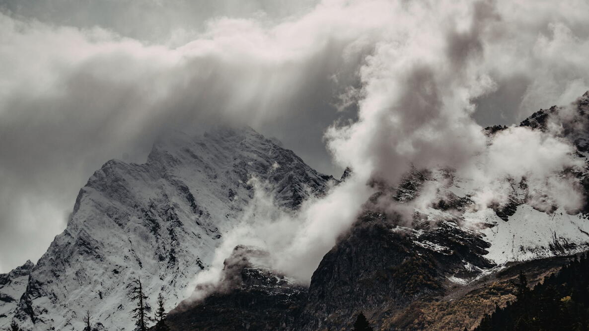

Avalanches are among the most powerful and unpredictable forces in nature. In seconds, a stable snow-covered slope can fracture, collapse, and roar downhill at highway speeds—sweeping up snow, rocks, trees, vehicles, and people in its path. While they’re often associated with dramatic mountain landscapes, avalanches can also occur on smaller slopes and even rooftops.
Understanding what causes avalanches, when they’re most likely to occur, and how changing weather patterns influence snowpack stability is essential for winter safety. From heavy snowfall and wind loading to warming temperatures and rain-on-snow events, multiple factors can turn a quiet slope into a dangerous slide zone.

What Causes an Avalanche?
Avalanches are deadly and uncontrollable, in addition to being notoriously difficult to forecast. However, decades of observation and study indicate that they occur most frequently during snowstorms, within 24 hours of a heavy snowfall, or when winds load slopes with snow.
They can also occur days or even months after a snowfall if conditions are favorable.
An avalanche will occur when the weight of snow on a slope exceeds its ability to remain stationary. Most avalanches occur on slopes of between 30 and 45 degrees, although in springtime, wet avalanches can occur on 20-degree inclines. Some or all of the snowpack collapses, fractures (or breaks), and flows downhill—with dry avalanches reaching speeds of 60 to 80 miles per hour within 5 seconds.
During the cascade, the avalanche gathers additional snow as well as objects in its path—rocks, trees, and, potentially, people (e.g., skiers) and vehicles (e.g., snowmobiles).
The scale of an avalanche can range from small, such as snow sliding off a rooftop, to enormous, such as snow cascading down a mountain slope or ridgeline—but the damage can be catastrophic no matter the size. A rooftop avalanche can easily bury workers, children, or animals, while a mountain avalanche can eliminate roads or entire towns several miles downslope from its point of origin.
Top Avalanche Triggers
- Heavy snowfall within 24 hours
- Strong winds loading slopes
- Slopes between 30 and 45 degrees
- Rapid warming
- Rain on snow
- Weak, faceted snow layers
How Climate Change Affects Avalanche Risk
| Climate Factor | Snowpack Effect | Avalanche Impact |
|---|---|---|
| Warmer Winters | More melt-freeze crusts | Persistent weak layers |
| More Rain | Heavier snowpack | Increased slide potential |
| Slower Jet Stream | Extreme weather swings | Greater unpredictability |
| Heavy Snow Events | Rapid loading | Larger avalanches |
A warming climate makes avalanche prediction more difficult and avalanche events potentially more dangerous. Projected changes in climate (e.g., warmer temperatures, on average) will affect both individual weather events and the long-term expectations of avalanche activity.
Warming temperatures tend to slow the jet stream, the air currents that flow approximately 35,000 feet above Earth’s surface and largely control weather patterns. As the jet stream slows, it becomes wavier, dipping farther south and rising farther north. We expect a slower, wavier jet stream to generate more frequent extended dry periods (days without precipitation) during which the warm air and sunshine act together to accelerate snowmelt (assuming, of course, that snow has fallen).
Increased snowmelt during winter months influences avalanche size and frequency. The jet stream will also generate more frequent heavy precipitation periods, too.

How Melt-Freeze Cycles Increase Danger
More melt days make existing snowpacks shallower, or less deep, than they would typically be during the middle of winter. Shallow snowpacks are weaker due to the dramatic temperature differences between the warm soil below the snow and the cold air in the atmosphere. This temperature difference promotes the development of granular snow, called “faceted” snow. (If you have ever plunged thigh-deep into sugary snow, you’ve met a weak, faceted snowpack!)
When a faceted snowpack becomes loaded with new heavy and wet snow, it gives way or collapses (think of pouring granulated sugar). This creates a large and potentially deadly avalanche. These kinds of snowpacks are most common in cold, high-elevation mountains, such as in the interior Canadian Rockies of British Columbia and Alberta, as well as Montana, Wyoming, Colorado, and Utah. Although rare, they can also occur in the Northeast.

In addition, surface snow that melts on warm days and/or during periods of plentiful sunshine often refreezes at night into a crust layer. Frozen crusts form a slick, less stable surface on which newly fallen or wind-deposited snow will slide. Once buried, crusts act as a moisture source or barrier within the snowpack.
This can lead to weak layer formation that can persist throughout the snow season, prolonging the risk of an avalanche. These slick layers can form again and again on top of each other, especially in sunny places like California, potentially increasing the avalanche risk for every subsequent snowfall event after a crust forms.
How Rain Affects Avalanches
A warming climate means that precipitation will increasingly fall as rain, rather than snow. Rain falling on a cold snowpack can refreeze upon hitting it, forming a layer that—just like the melt-freeze crust—can create a later avalanche hazard when more snowfall is added. This can also lead to weak layers by changing how moisture and energy flow through the snowpack.
Heavy rainfall can saturate the snowpack, increasing its mass and therefore the risk of an avalanche. This is a big problem not only in spring but also during warm winter storms. In extreme cases, rainfall flowing through the snowpack or snowmelt following days of extremely warm and sunny conditions saturates the soil beneath it.
Melt water can lubricate the area where the snow meets the soil, leading to reduced soil and snowpack strength. When this happens, landslides that mix soil with snow to create dangerous debris flows can be triggered.
Such an event happened on Slide Mountain, Nevada, during a heat wave in the spring of 1983 that followed an extremely snowy winter. Beginning near 9,000 feet, this debris flow traveled 4,000 vertical feet and over 3 miles down a canyon, where it moved houses off their foundations and damaged a highway as it spilled into Washoe Valley. Unfortunately, one life was also lost, and a number of injuries were reported.
Extreme Weather Leads to Avalanches
Predictive tools such as Earthsystem models help us to understand the effects of changes in the atmosphere, including jet streams. For example, these tools are predicting stronger winter snow and rain storms in a warmer climate, due to, for example, atmospheric rivers (long, narrow corridors of water vapor steered by the jet stream’s fast-moving winds).
More moisture means more fuel for precipitation, while stronger winds lift moisture over mountainsand more effectively wring out this wetness as precipitation. The end result? Heavier, longer-lasting precipitation in the form of rain at increasingly higher elevations and snow in the highest mountains.
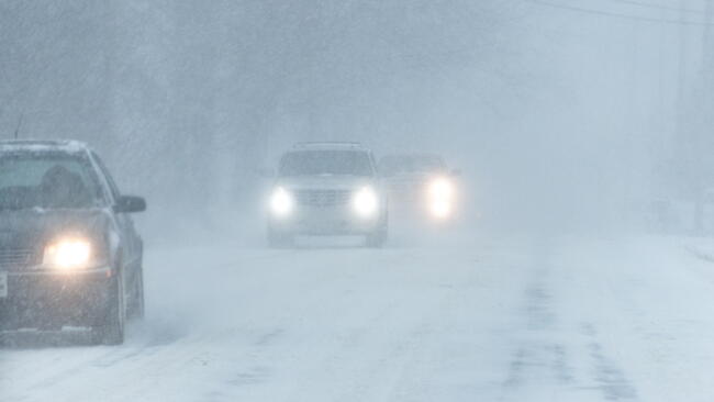
Within warmer, windier winter storms, which may last longer than we are used to—in the same way that recent heat waves or dry spells have been growing longer—we expect higher precipitation rates and larger multiday precipitation totals. Both increase the chances of low-elevation flooding and higher elevation heavy snow accumulation.

Heavy snowfalls onto shallower and weaker snowpacks—those more likely to have melt-freeze or rain crusts or sugary, faceted snow—suggest that avalanches on mountains and rooftops could become more frequent, widespread, and large.
A slower, wavier jet stream will also cause occasional extreme cold outbreaks, bringing heavy snow to places that rarely experience it. In these cases, the potential for rooftop avalanches increases.
Extreme cold makes shallow snowpacks weaker by helping to create noncohesive, sugary, faceted snow grains rather than promoting bonds to form between snow grains that strengthen the snowpack. After extreme cold periods—especially those that occur in early winter—subsequent storms load the weakened snowpack and increase the chances of an avalanche.
As extended periods of extreme weather become more common, warmer, sunnier, and rainier conditions will reduce overall chances of avalanche formation at lower elevations. At higher elevations, however, the risks are likely to magnify with increasingly variable and changing weather. The white dragon will continue to lurk in snowscapes—and can awaken when we least expect it.
Frequently Asked Questions
What slope angle is most dangerous for avalanches?
Most avalanches occur on slopes between 30 and 45 degrees. Wet spring avalanches can occur on slopes as gentle as 20 degrees.
Can avalanches happen after clear weather?
Yes. Avalanches can occur days or even months after a snowfall if weak layers exist beneath the surface and new snow or warming temperatures add stress.
How fast do avalanches travel?
Dry avalanches can reach speeds of 60 to 80 miles per hour within seconds, making escape extremely difficult.
Does rain increase avalanche risk?
Yes. Rain adds weight to the snowpack and can create slippery crust layers, both of which increase the likelihood of avalanches.
Does climate change affect avalanches?
Warming temperatures, increased rain-on-snow events, and more variable winter weather can weaken snowpacks and increase avalanche unpredictability, especially at higher elevations.
Are avalanches becoming more frequent?
Risk patterns are shifting. Some lower elevations may see reduced snow cover overall, but higher elevations could experience heavier snowfall events and unstable snow layers, increasing potential avalanche danger.
What are the warning signs of avalanche danger?
| Warning Sign | What It Means |
|---|---|
| Cracking snow | Weak layer collapse |
| “Whumpfing” sound | Snowpack settling |
| Recent heavy snowfall | Fresh load on slope |
| Rapid temperature rise | Weakening bonds |
Recent heavy snowfall, strong winds, rapid warming, cracking sounds in the snow, and visible fractures or “whumpfing” noises are all red flags.
Avalanches don’t happen at random. Heavy snowfall, wind, warming temperatures, rain, and weak snow layers all increase the risk. Understanding these triggers—and recognizing warning signs like recent storms or cracking snow—can help you stay safer in winter conditions.
As weather patterns grow more extreme and variable, avalanche risk may become less predictable, especially at higher elevations. Awareness, preparation, and respect for the snowpack remain your best defense.

Comments