
It’s the fight of the century (or at least the year)! The winner decides where we have winter storms or drought. And we all have a ringside seat!
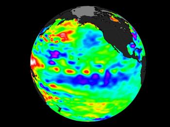

Meet the duelers—on the left, La Niña and on the right the Positive PDO (blue=cool, red=hot). Sources: NASA and NOAA
On this side is the mighty La Niña. She may be named the “Little Girl”, but this Tropical Pacific weather pattern cools one tenth of the globe. On the other side is the mighty Positive PDO (Pacific Decadal Oscillation), the Northern Pacific weather (north of Mexico) pattern that can bake or flood the USA.
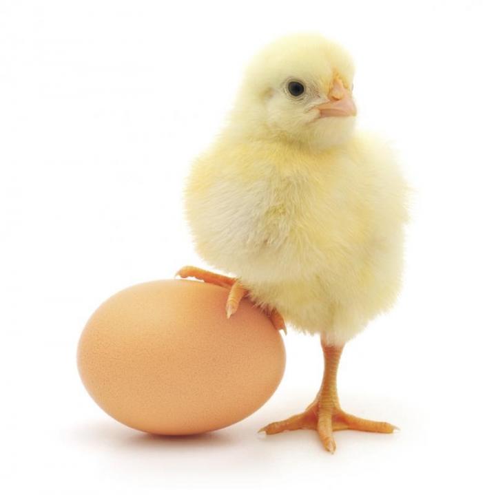
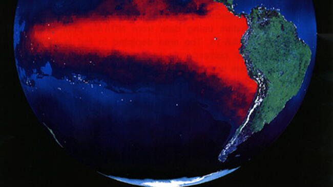
The Chicken and the Egg ‒ El Niño/La Niña and the PDO Source: Wikimedia
Think of the tropical El Niño/La Niña as the chicken and the PDO as the egg. The warm water from the tropical El Niño flows up along the west coast of the Americas into the North Pacific. This creates the positive/warm PDO. Last year’s very hot El Niño created this year’s positive/warm PDO. Now the tropics have flipped to a cool La Niña condition but there has not been enough time for the colder water to go north and make a negative/cool PDO. It’s warm in the north and cold in the tropics and they are fighting each other.
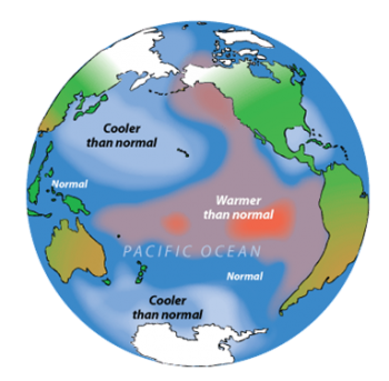
El Niños help create Positive PDO’s in the North Pacific. (Left) La Niñas help create Negative PDO’s. (Right) Source: NOAA
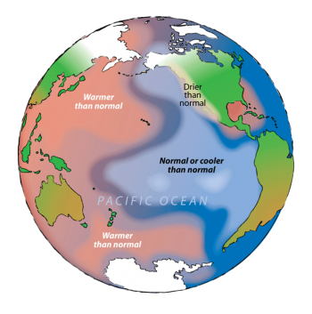
Positive/warm PDO’s put warm water off the California coast, which warm the air above it and create weather patterns that blocks some of the winter rainfall in parts of the northwestern United States. Negative/cool PDO’s chill the waters off the West Coast and that leads to a greater chance of dry weather in the Southwest. This year’s positive PDO is worrisome for Californians hoping for rainfall.
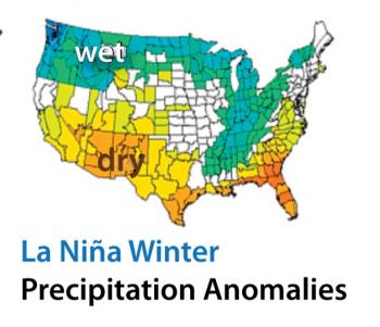
Meanwhile La Niña typically creates its own weather patterns—almost the exact opposite pattern as the one the positive/warm PDO normally creates.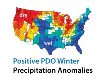
Two huge weather Pacific weather patterns—which one will shape our winter?
It will be a duel worth watching and will shape how wet and stormy Texas or the Midwest will be. With the Pacific Ocean off our West Coast we will have a ringside seat. Stay tuned!

Comments